French Vintage Prints
1892 Antique Hautes Alpes map
1892 Antique Hautes Alpes map
Regular price
$39.00 USD
Regular price
Sale price
$39.00 USD
Unit price
per
Tax included.
Shipping calculated at checkout.
Couldn't load pickup availability
Materials
Materials
Paper
Dimensions
Dimensions
Page approx. 31 x 21.8 cm (12’’ 1/4 x 8’’ 1/2), margins included. Map approx. 23.5 x 15.2 cm (9’’ 1/4 x 6’’)
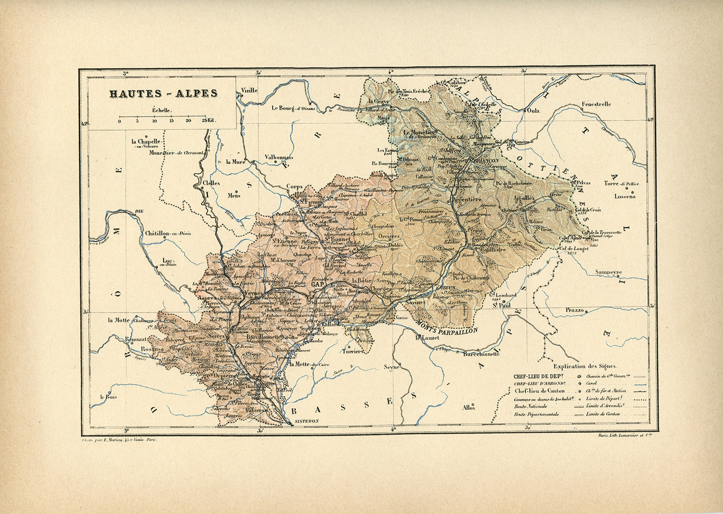
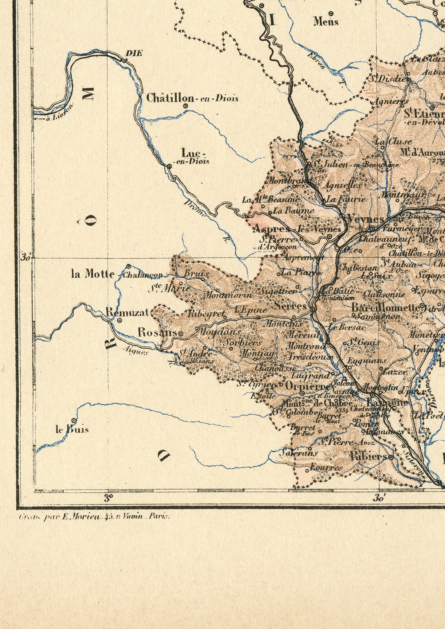
Gorgeous little engraving showing a delicately colorized map of a French department: the Hautes Alpes department.
Do you know where it is situated? As you may know, France is divided in 101 department. This one is in the South of the Alps, not very far North of Provence.
Interestingly enough, this map predates the creation of ski resorts so it shows the mountain areas as they were before the boom of the winter sports industry. It's prefecture (capital city) is the town of Gap.
The main towns are Gap and Briançon, an area loved by trekkers for its magnificent mountain trails. It mentions the site of La Grave, mythical among ski riders.
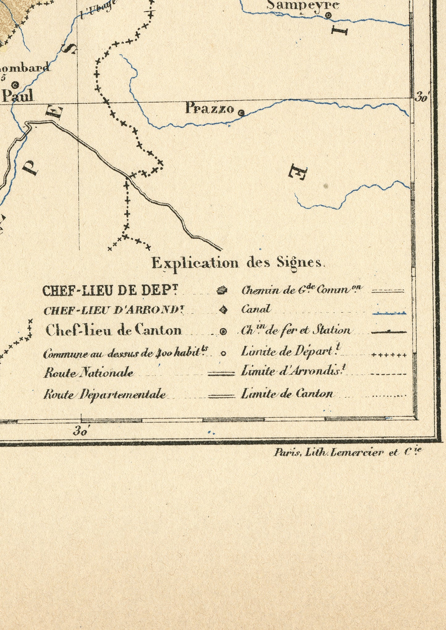
This dictionary page comes from a rare damaged 1892 French Trousset dictionary. It is a lithograph and was engraved on thick paper. Under the map, there are in both bottom corners mentions of the company which engraved it (Imp. Lemercier & Cie, Paris) and even of the person who did the actual engraving (E. Morieu, who lived 45 rue Vavin in Paris). Isn't that perfect?
ONLY ONE IN STOCK
SIZE : Page approx. 31 x 21.8 cm (12’’ 1/4 x 8’’ 1/2), margins included. Map approx. 23.5 x 15.2 cm (9’’ 1/4 x 6’’)
AUTHENTICITY : You will receive an authentic book page from 1892, which comes from a damaged volume. The paper is yellowed, as befits its age but the engraving is in very good condition.
SHIPPING : Your prints ship in a cellophane bag and a cardboard-reinforced envelope. The mat and frame are NOT included.
View full details
Do you know where it is situated? As you may know, France is divided in 101 department. This one is in the South of the Alps, not very far North of Provence.
Interestingly enough, this map predates the creation of ski resorts so it shows the mountain areas as they were before the boom of the winter sports industry. It's prefecture (capital city) is the town of Gap.
The main towns are Gap and Briançon, an area loved by trekkers for its magnificent mountain trails. It mentions the site of La Grave, mythical among ski riders.
This dictionary page comes from a rare damaged 1892 French Trousset dictionary. It is a lithograph and was engraved on thick paper. Under the map, there are in both bottom corners mentions of the company which engraved it (Imp. Lemercier & Cie, Paris) and even of the person who did the actual engraving (E. Morieu, who lived 45 rue Vavin in Paris). Isn't that perfect?
ONLY ONE IN STOCK
SIZE : Page approx. 31 x 21.8 cm (12’’ 1/4 x 8’’ 1/2), margins included. Map approx. 23.5 x 15.2 cm (9’’ 1/4 x 6’’)
AUTHENTICITY : You will receive an authentic book page from 1892, which comes from a damaged volume. The paper is yellowed, as befits its age but the engraving is in very good condition.
SHIPPING : Your prints ship in a cellophane bag and a cardboard-reinforced envelope. The mat and frame are NOT included.