French Vintage Prints
1892 Antique Var Map - France
1892 Antique Var Map - France
Impossible de charger la disponibilité du service de retrait
Matériaux
Matériaux
Dimensions
Dimensions
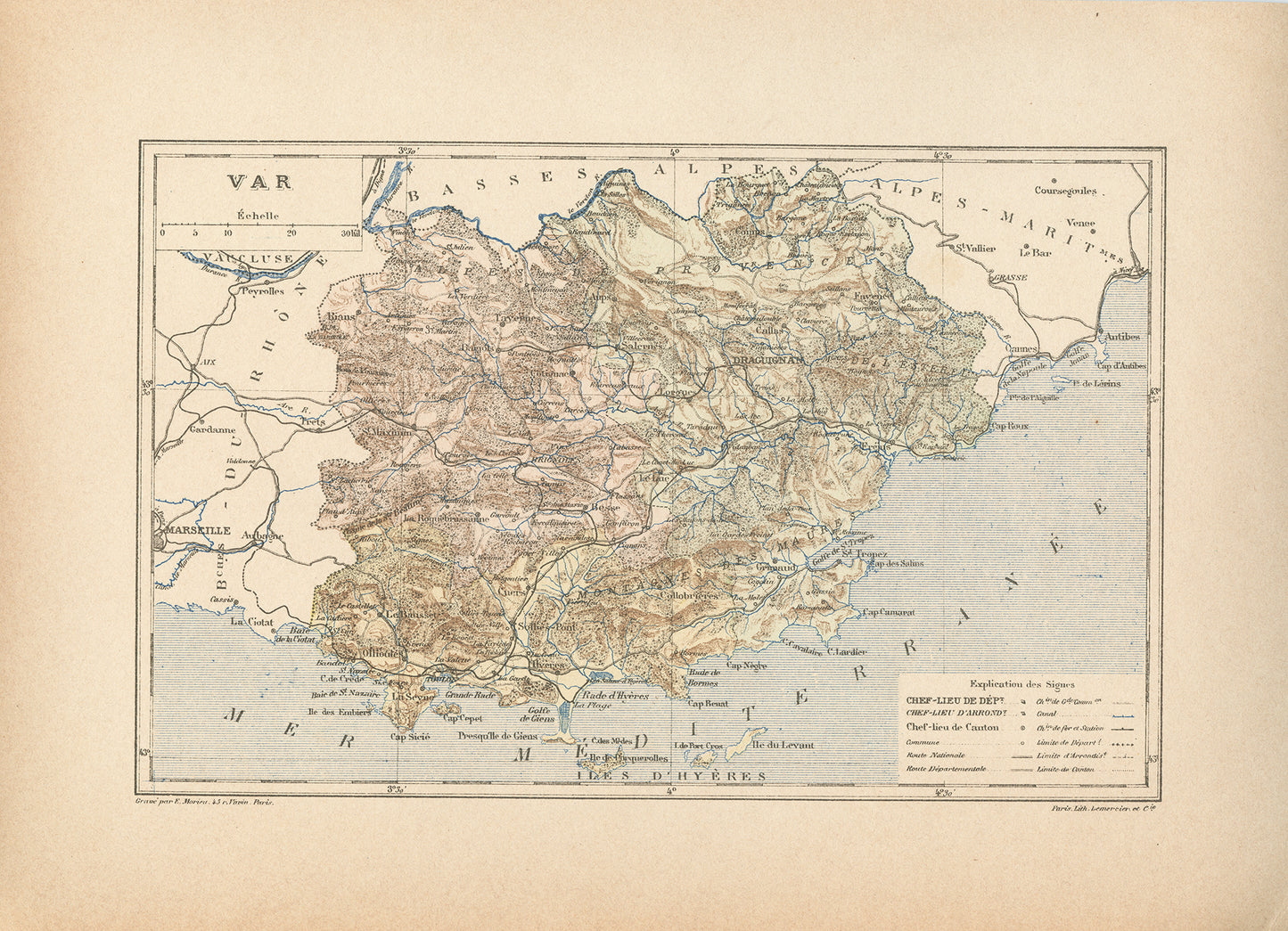
The French Riviera, known in France as the Côte d'Azur is definitely one of the most iconic French travel destination. It encompasses the extreme Eastern coast on the Mediterranean sea, stretching from Menton, at the Italian border back to the the Gulf of Giens.
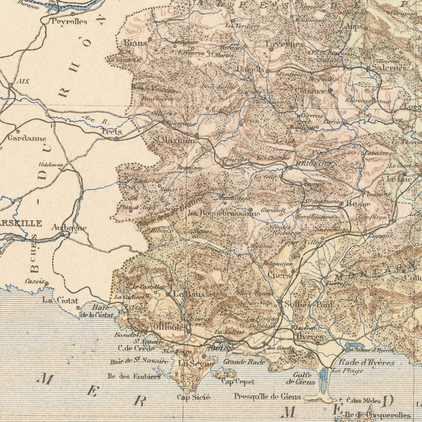
This gorgeous little engraving shows a delicately colorized map of the Western part of that beautiful French region: the Var department. As you may know, France is divided in 101 department. The capital city of this one is the city of Toulon, one of the most famous naval ports in France.
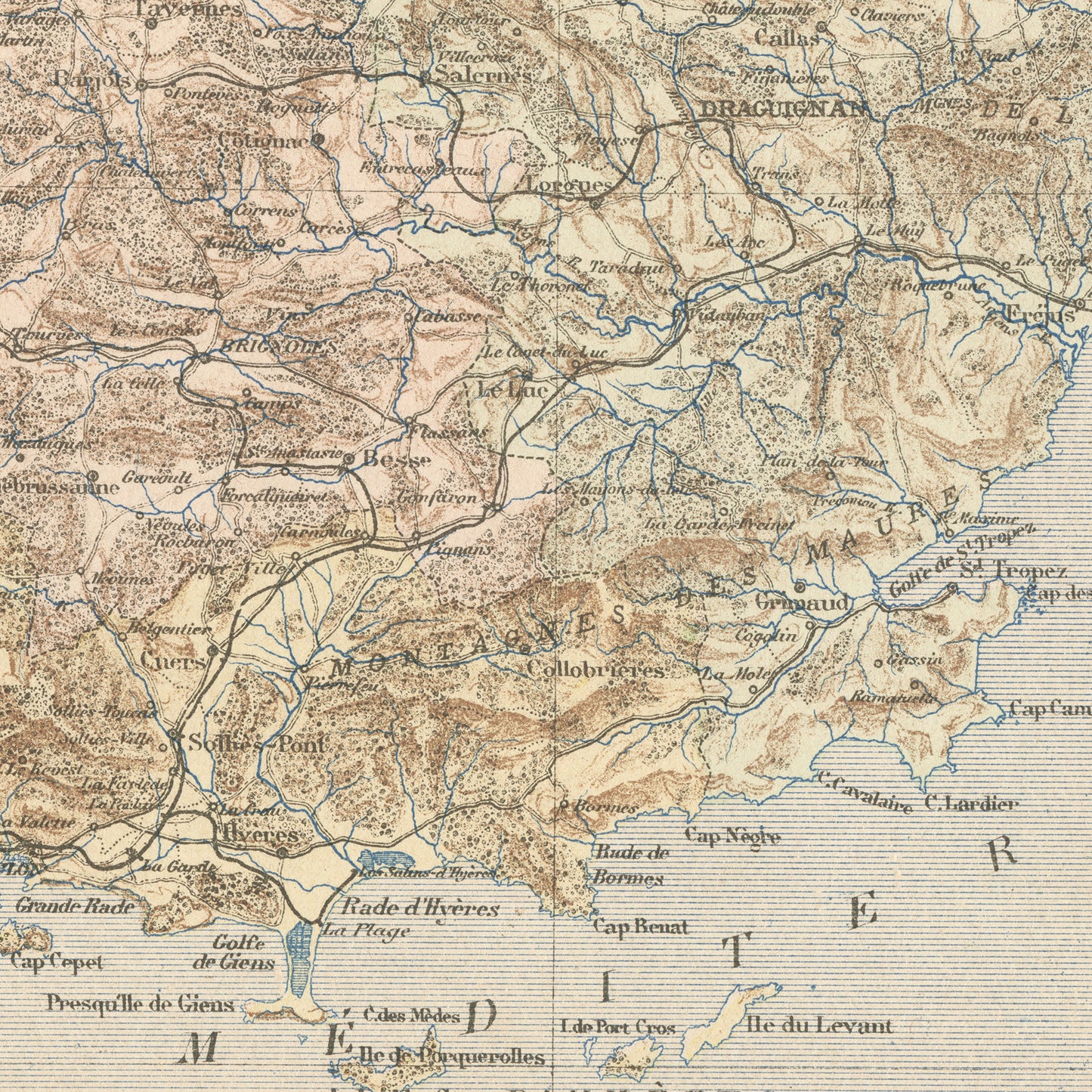
The famous places in this area are the village of Saint-Tropez, the Porquerolles island and the Cap Nègre, beloved by many painters.
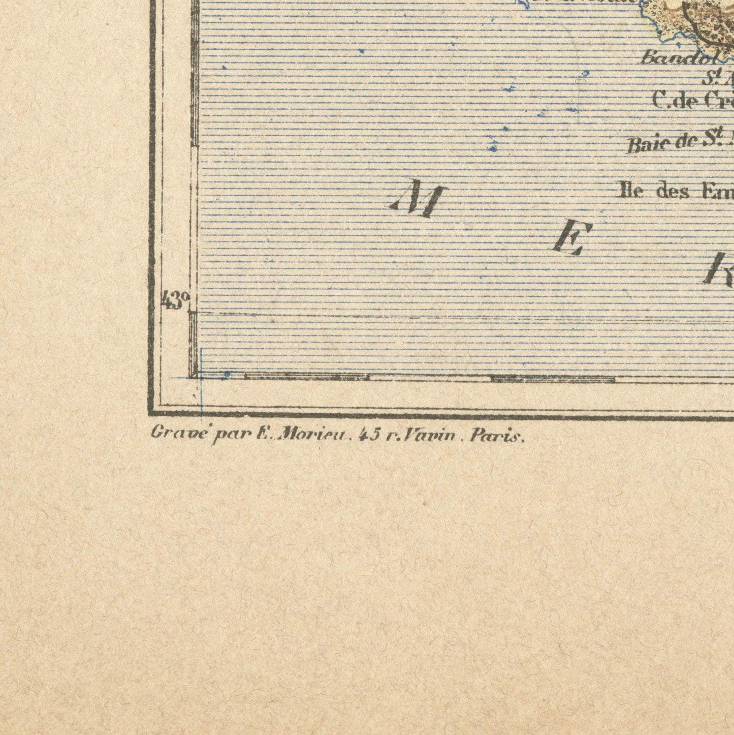
This dictionary page comes from a rare damaged 1892 French Trousset dictionary. It was engraved on thick paper. Under the map, there are in both bottom corners mentions of the company which engraved it (Paris Lith. Lemercier % Cie) and even of the person who did the actual engraving (E. Morieu, who lived 45, rue Vavin in Paris). Isn't that perfect?
SIZE : Page approx. 31 x 21.8 cm (12’’ 1/4 x 8’’ 1/2), margins included. Map approx. 23.5 x 15.2 cm (9’’ 1/4 x 6’’)
AUTHENTICITY : You will receive an authentic book page from 1892, which comes from a damaged volume. This is NOT a copy. The paper is yellowed, as befits its age but the map is in very good condition.
SHIPPING
- Ships from Switzerland in a cellophane bag and a cardboard-reinforced envelope.
- The mat and frame are NOT included.