French Vintage Prints
1892 Antique French Basses Alpes Map
1892 Antique French Basses Alpes Map
Prix habituel
$39.00 USD
Prix habituel
Prix soldé
$39.00 USD
Prix unitaire
par
Taxes incluses.
Frais d'expédition calculés à l'étape de paiement.
Impossible de charger la disponibilité du service de retrait
Matériaux
Matériaux
Dimensions
Dimensions
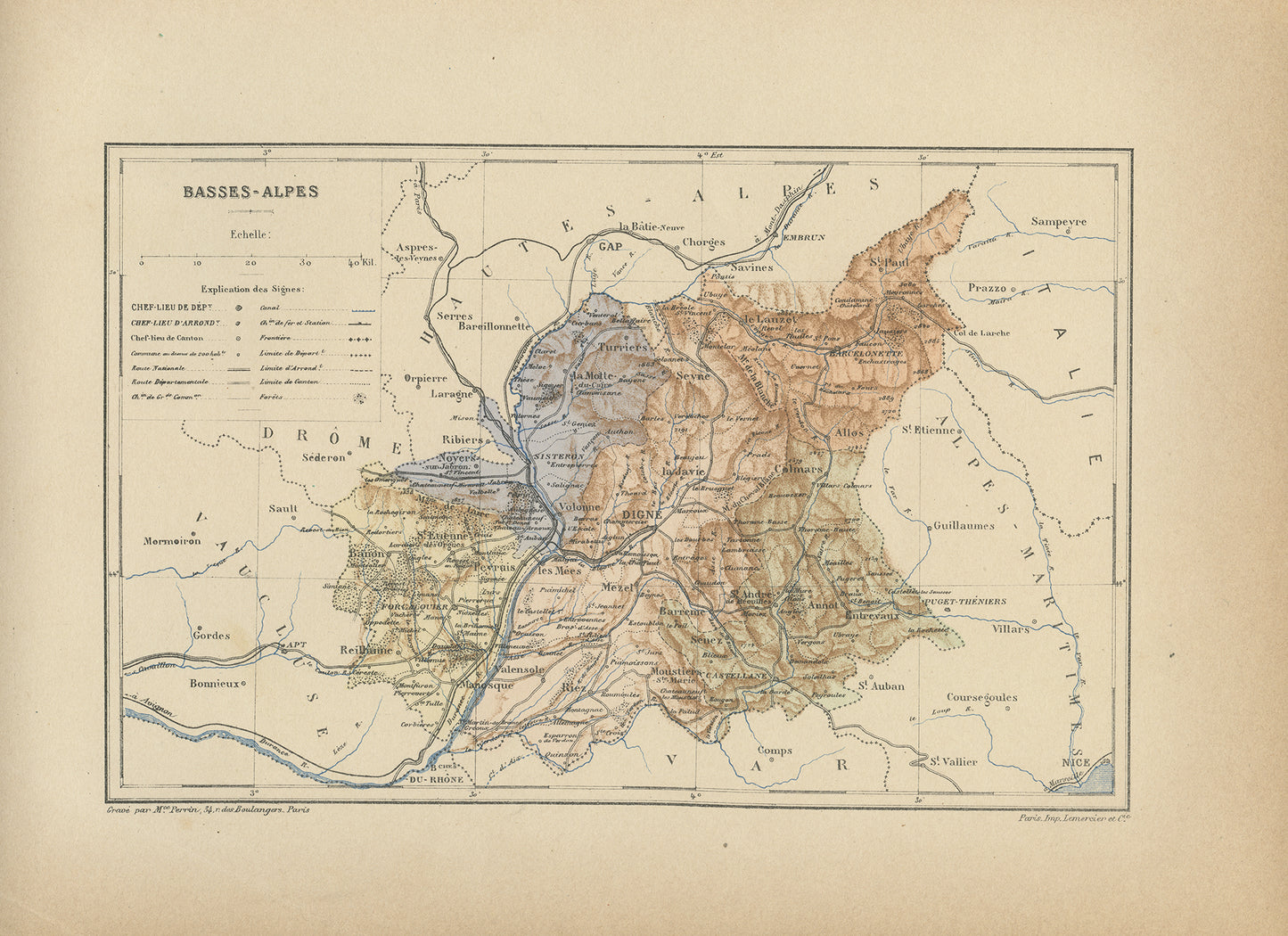
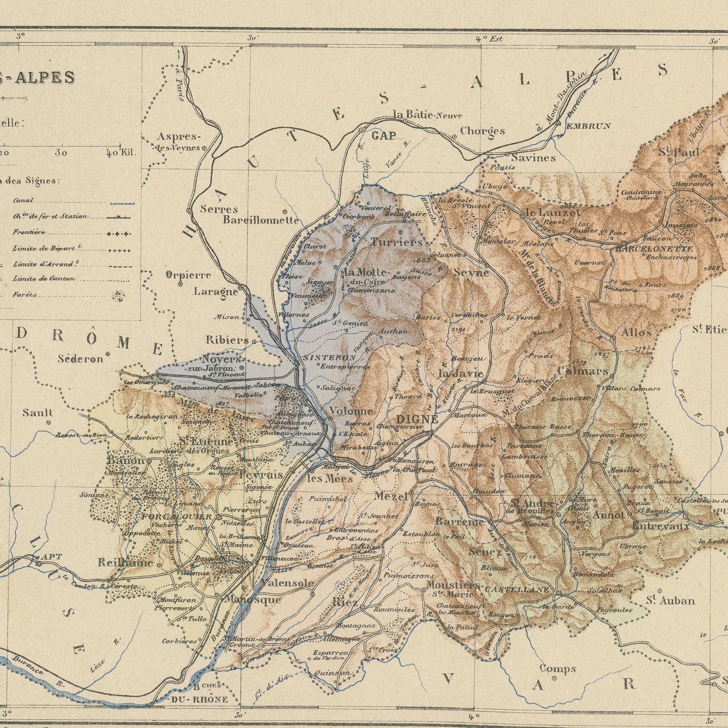
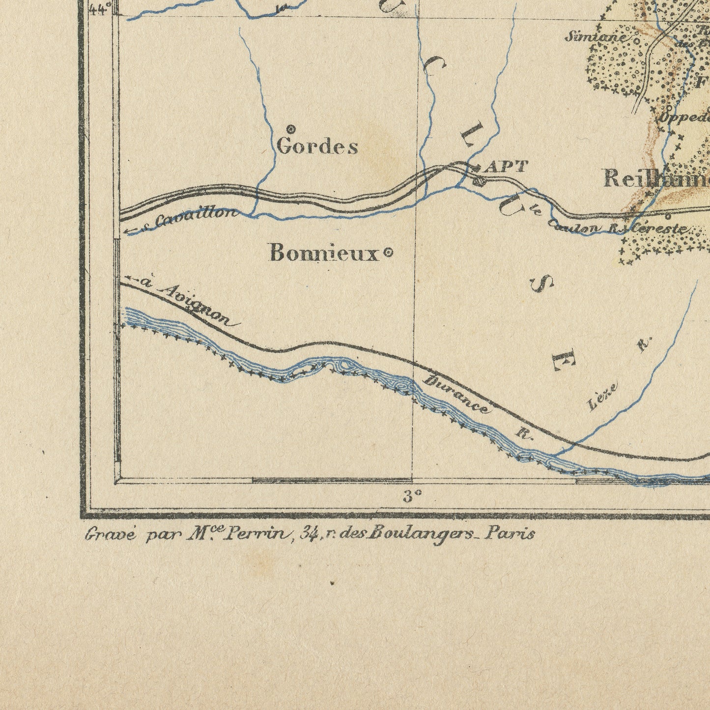
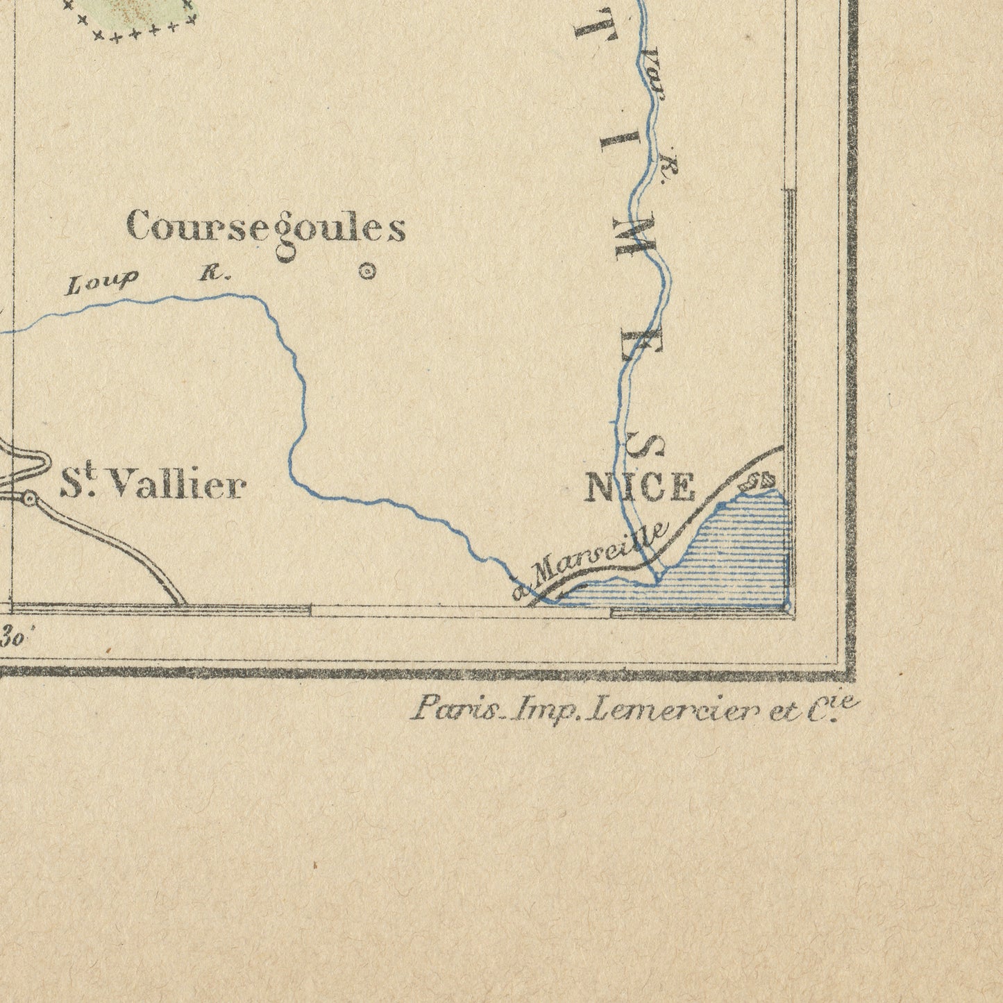
Gorgeous little engraving showing a delicately colorized map of a French department: the Basses Alpes department, nowadays called Alpes de Haute Provence.
Do you know where it is situated? As you may know, France is divided in 101 department. This one is in the South of the Alps, where the mountains meet the North of Provence.
Interestingly enough, this map predates the creation of ski resorts so it shows the mountain areas as they were before the boom of the winter sports industry. It's prefecture (capital city) is the town of Dignes-Les-Bains.
The main towns are Manosque, Sisteron, Château-Arnoux-Saint-Auban, Oraison, Forcalquier, Les Mées, Pierrevert, Villeneuve, Sainte-Tulle, Gréoux-les-Bains, Barcelonnette and Castellane.
This dictionary page comes from a rare damaged 1892 French Trousset dictionary. It was engraved on thick paper. Under the map, there are in both bottom corners mentions of the company which engraved it (Imp. Lemercier & Cie, Paris) and even of the person who did the actual engraving (Mce Perrin, who lived rue des Boulangers 34 in Paris). Mce is short for Maurice. Isn't that perfect?
SIZE : Page approx. 31 x 21.8 cm (12’’ 1/4 x 8’’ 1/2), margins included. Map approx. 23.5 x 15.2 cm (9’’ 1/4 x 6’’)
AUTHENTICITY : You will receive an authentic dictionary page from 1892, which comes from a damaged volume. This is NOT a copy. The paper is yellowed, as befits its age but the map is in very good condition.
Afficher tous les détails
Do you know where it is situated? As you may know, France is divided in 101 department. This one is in the South of the Alps, where the mountains meet the North of Provence.
Interestingly enough, this map predates the creation of ski resorts so it shows the mountain areas as they were before the boom of the winter sports industry. It's prefecture (capital city) is the town of Dignes-Les-Bains.
The main towns are Manosque, Sisteron, Château-Arnoux-Saint-Auban, Oraison, Forcalquier, Les Mées, Pierrevert, Villeneuve, Sainte-Tulle, Gréoux-les-Bains, Barcelonnette and Castellane.
This dictionary page comes from a rare damaged 1892 French Trousset dictionary. It was engraved on thick paper. Under the map, there are in both bottom corners mentions of the company which engraved it (Imp. Lemercier & Cie, Paris) and even of the person who did the actual engraving (Mce Perrin, who lived rue des Boulangers 34 in Paris). Mce is short for Maurice. Isn't that perfect?
SIZE : Page approx. 31 x 21.8 cm (12’’ 1/4 x 8’’ 1/2), margins included. Map approx. 23.5 x 15.2 cm (9’’ 1/4 x 6’’)
AUTHENTICITY : You will receive an authentic dictionary page from 1892, which comes from a damaged volume. This is NOT a copy. The paper is yellowed, as befits its age but the map is in very good condition.